Next General Meeting will be held on June 29, 2021, 10:00.
Investor relations
MotoGP Grand Prix in Brno. What have we learnt about our Big Data systems?
CE-Traffic offers location-based Big Data services: Real-time traffic and Geodemography. The first one uses Floating Car Data technology to analyze over 25 million kilometers of anomymous GPS tracking data daily to generate high-quality real-time and predictive traffic information. Our second system uses anonymous signaling data from mobile network operators to provide unique macro-scale geodemographic statistics (or Location Insight Service).
We decided to use the opportunity of MotoGPS Grand Prix – premier championship of motorcycle road racing in Brno – to investigate quality and correlation of our two independent systems. Our Geodemography system was monitoring number of people present in the area of the Masaryk Circuit, and Floating Car Data technology allowed us to generate precise traffic information on D1 highway in the radius of 5km away from the circuit.
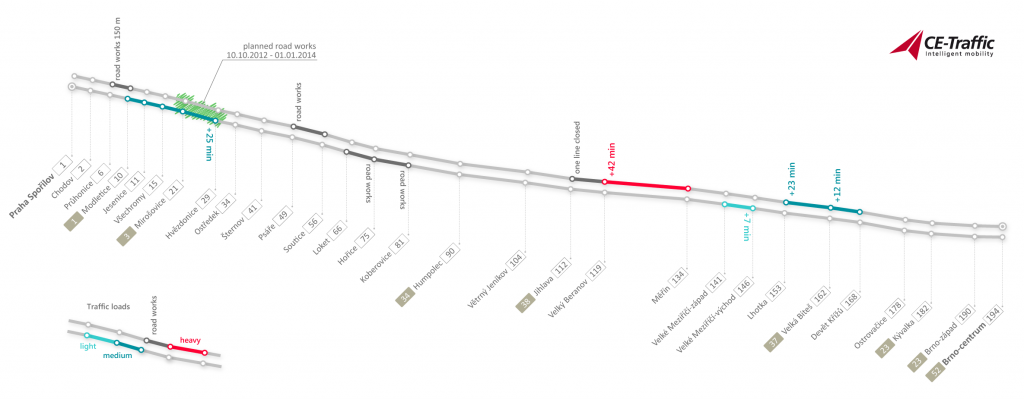
Sunday, 25th of August was the last day of the event. People started to arrive at the venue early in the morning. Around 1:00 pm one could observe the peak – almost 140,000 people present. After end of the last run people started to leave the circuit area. 100,000 people in 3h time-span. At 3 pm D1 highway in the 5km radius around the circuit started to be jammed with 20 min delay where typical ETT is around 5 min. Two hours later the delay grew up to almost 85 min. 5 km in 1,5 hours…
This example shows that the correlation of the two systems in very high. Using Ce-Traffic historical data about similar events around the Central and Eastern Europe gives new possibilities in analysis of mass behavior during large events which is extremely important e.g. for crisis scenario modelling.
NEW! CE-Traffic Premium RDS-TMC available in Slovakia
After successful launch of the PREMIUM RDS-TMC in Poland last year, CE-Traffic expands the service to Slovakia, creating the first Traffic Message Channel in this country.
“We are pleased that our TMC service is now available also to drivers in Slovakia. RDS-TMC works in many Western European countries for many years already. In the last two years the TMC service launched in many countries of Eastern Europe as well. By combining our traffic data of current traffic flow generated by unique technology of floating cars enriched with data of road works and traffic restrictions of the Slovak administration highways portal and other public sources we have created the optimal TMC service. Thanks to the cooperation with Fun Radio, the leading Slovak Radio with appropriate national broadcast network, we broadcast the traffic content on the territory of Slovakia. With our first customer – Garmin – may now begin Slovak drivers to use this simple, practical and affordable channel for receiving traffic information,” says Jiří Novobilský, CEO of CE-Traffic.
CE-Traffic PREMIUM RDS-TMC is the state-of-the-art TMC solution which offers drivers in Poland and Slovakia access to unique traffic data. Information about traffic congestions and delays is generated using Floating Car Data technology based on fleet of vehicles that generates daily over 25 mln kilometers of anonymous GPS tracking data. Fused with journalistic road events monitored by our local Traffic Information Centers and smartly filtered using our know-how about local drivers behavior our Premium RDS-TMC is the best available TMC service in Central and Eastern Europe.
INTENS Corporations s.r.o. launches new service with our data
INTENS Corporations s.r.o. launched a new personalized traffic service for both professionals and the general public on www.mojedopravni.info.
The service provides real-time traffic information in a personalized way. Users can set-up their own routes e.g. to work, to home, to gym etc. and they will receive information by email or SMS about current traffic conditions as often as they wish.
Until first half of May 2013 the service is available on testing web doprava.intens.cz. There are 14 days of free usage after registration. Feedback would be very appreciated by the creators. There is also a demo account where is not needed to create an account in order to test the service.
Geodemographics – Brings Location Intelligence To The Next-Level
Using anonymous mobile phone signaling data CE-Traffic provides unique customer insight that was never before available. While regular Business Intelligence systems will handle the “Who”, “What” and “When” factors specific to your organization, our Retail Geo-intelligence will give you answers to crucial questions that will bring finer grained understanding of spatio-temporal behaviour of your customers. Where your customers live, work, spend free time? Is your store located better than your competitor’s? Has outdoor advertising, flyer campaign or sent catalogues driven customers to your location? How long does it take for customers to reach your storefront?
In today’s retail business environment, location matters more than many people imagine. Organizations can use location-based data to manage physical assets and resources, personnel, suppliers, customers as well as to plan, optimize and assess their marketing strategy. This data can be geo-visualized, explored and investigated by combining the power of Business Intelligence and Geographic Information Systems.
But image that all location data
The ability to visualize spatial data and understand relationships between specific locations, helps organizations make more strategic business decisions. We call this location intelligence, and by leveraging location-based data, companies can identify business growth opportunities and improve the sharing of information.
Location is a central factor in business.
Location Intelligence tools leverage a variety of data sources including aerial maps, geographic information systems (GIS), consumer demographics as well as a user’s own customer records. It provides a third party view of the “Where” and “Who” factor. Popularized by business to consumer (B2C) applications, location Intelligence is experiencing rapid acceptance. While typical Business Intelligence systems handle the “Who”, “What” and “When” factors specific to the organization, the integration of BI and GIS allows for new types of analyses by adding the “Where” factor and third party data to the analyses.
Allowing businesses or other entities to better understand external characteristics and how they affect their operations – gaining a much more complete picture
Enabling an analysis of location and time dimensions of business and external data to gain much finer grained understanding of phenomenon
Geomarketing is a set of tools and methods based on Geographic Information Systems (GIS) focused mostly on three aspects: analysing spatial customer behavoir, retail location and spatial marketing management. Geomarketing methodology can be used to spatialy analyze and optimize elements of marketing processes.
CE-Traffic provides unique geomarketing data to spatially plan and evaluate your marketing campaigns, analyze attractiveness of locations, perform time accessibly anaysis, get unique customer insights.
About Us
-
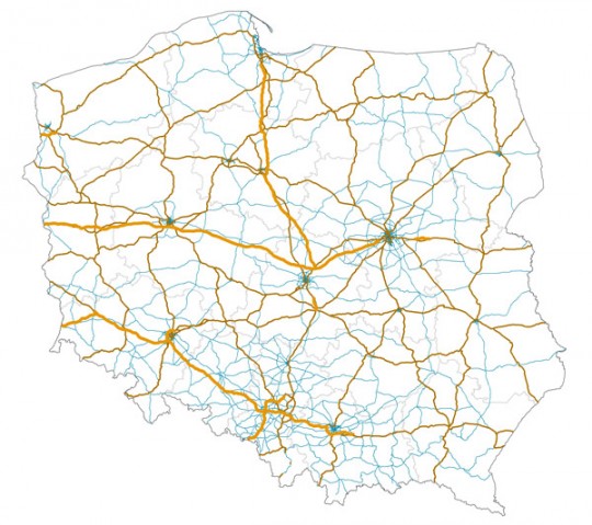
CE-Traffic is a provider real-time traffic information services based on the Floating Car Data technology. Currently we operate traffic systems in Poland, Czech Republic, Slovakia and offer our services for wide range of markets: personal navigation, navigation for mobile, internet, media and goverments.
-
Floating Car Data technology is able to generate detailed information for entire states based on the continuous analysis of anonymous transactions describing movement of mobile phones between antennas of a mobile operator network or based on analysis of anonymous GPS data of commercial fleets.
Personal Navigation
CREATE TRUE VALUE FOR DRIVERS BY OFFERING THEM ONE OF HIGH QUALITY CE-TRAFFIC REAL-TIME SERVICES
Over last decade personal navigation has became a product of everyday use for millions of people in Central and Eastern Europe. Over-saturated market and high expectancy of users brings the need to compete by offering not only the best hardware, software and up-to-date maps but also real-time traffic information which became a must-have feature of navigation apps and PNDs.
CE-Traffic offers a complete portfolio of solution for navigation apps, connected devices and TMC enabled PNDs. All the solutions are designed for fast implementation with the best available accuracy and coverage within the region. Our TMC Location Table is implemented by major global and local geographic data providers including TomTom, Here and Emapa. We also support dynamic location referencing method OpenLR in order to reference our data to maps and systems of other vendors.
Live Traffic XML is products designed for navigation apps and connected PNDs. Premium RDS-TMC offers real-time traffic service for drivers with TMC-enabled PND.
Tourism Statistics
WE PROVIDE UNIQUE REPORTS ABOUT FOREIGN AND DOMESTIC TOURISTS
- Data about tourism is essential for governmental agencies, cities, municipalities, banks, consulting companies and many other organizations. CE-Traffic provides unique reports about foreign and domestic tourists for national, regional, or specific area level.
-
This kind of data was traditionally gathered by conducting short term tourism surveys which were economically inefficient. CE-Traffic reports will give answers to following questions:
- How many foreign and domestic tourists?
- From which countries or regions?
- For how long?
- Where do they stay?
- What do they visit?
- Was the area promotional campaign successful?
Retail
UNIQUE LOCATION-BASED ANALYTICS ABOUT YOUR RETAIL LOCATIONS
- CE-Traffic offers next-generation of geospatial business intelligence which will give you customer insights that only recently become possible with mobile network technologies and advances in data processing and cloud computing.
Custom reports
- We analyse anonymous signaling of mobile phones and compute statistical profiles your customers based on where they live, work, shop or spend time. Moreover we will tell you not only where do you customers come from but also how long does it take to reach your storefront by different means of transport. We will also compare your business location site to site, or compare it with store fronts of your competition.
Monitor campaigns
- CE-Traffic Geodemography will let you monitor geographic performance and effectiveness of your marketing and promotional campaigns. We will give you access to near real-time statistics to evaluate or optimize your outdoor advertising campaign, flyer distribution campaign, or effectiveness of catalogues you send to your customers.
Site attractiveness
- If you are planing to expand your business we will help you assess attractiveness of new sites taking into consideration profiles of your customers, local geodemographic statistics and accessibility of sites. Accordingly we will help you select locations with lowest spatial attractiveness perspective if you are planning to reduce your storefronts.
Outdoor advertising
Traffic and transportation planning
Our geodemographic statistics brings new quality of data for traffic and transportation planners. We produce specific and accurate Origin-Destination (OD), and Home-Work (HW)matrices which are an essential source of data for public transportation as well as traffic modelling.
Performing traditional surveys is very expensive, gives only partial information for a short timespan. Our OD amd HW matrices will give you complete data for the whole investigated area for representative timespan. Moreover we will provide you time-series data per workday, weekends, holidays or selected day with split into several categories: visitors, residents, commuters, transit, tourists (domestic and foreign).
Retail geo-intelligence
UNIQUE INSIGHTS TO YOUR CUSTOMER’S SPATIO-TEMPORAL BEHAVIOUR
-
Using anonymous mobile phone signaling data CE-Traffic provides unique customer insight that was never before available. While regular Business Intelligence systems will handle the “Who”, “What” and “When” factors specific to your organization, our Retail Geo-intelligence will give you answers to crucial questions that will bring finer grained understanding of spatio-temporal behaviour of your customers:
-
CE-Traffic Retail Geo-intelligence provides data for business analysts or custom printed and interactive reports with geo-visualizations, graphs and in-depth analysis of the data to bring your unique knowledge and customer insight to your organization.
Site-Rank
- Site-Rank is a service essential for analysts and executives to choose optimum locations by the analysis of the relationship between geodemographics and site potential. Depending on your organization requirements Site-Rank offers several different variants:
-
Site-Rank can be provided as data for business intelligence systems or as custom printed and interactive reports with geo-visualization, graph and in-depth analysis to provide your organization with top-quality information that will enable you to make decisions based on knowledge.
CE-Traffic sponsors Polish ITS Congress 2013

We find it important to promote intelligent transportation technologies and solutions therefore CE-Traffic became a sponsor of Polish ITS Congress 2013. The event is held for the 6th time by the ITS Polska Association and it will address significant challenges that lies ahead of public sector as well as the whole Polish market.
We would like to invite all guests interested in innovative real-time traffic data technologies for presentation of Tomasz Przeździęk – Board Member of CE-Traffic for his presentation: “Use of Floating Car Data in urban Intelligent Transportation Systems. Prague case study”, which will demonstrate implementation of CE-Traffic data in Prague traffic management center. Feel free to talk us also next to our stand where we will show interesting traffic visualizations and data analysis.
This year Polish ITS Congress will take place under special circumstances, as the implementation of intelligent transportation systems is part of the first EU operational programme dedicated to ITS as well as the largest public contract in the ITS sector in Poland – national traffic management system, designed to cover all the motorways, express roads and selected national roads, has just started. We look forward to argumentative discussions with leading industry experts in Poland.
The event will be held at Mariott Hotel, Warsaw, on 13-14 May 2013. Learn more on PKITS website.
Automotive
CE-TRAFFIC OFFERS AUTOMOTIVE ORGANIZATIONS THE WHOLE PORTFOLIO OF TRAFFIC SERVICES FOR IN-DASH NAVIGATION.
- With the increasing popularity of mobile apps on smartphones, drivers expect more from in-dash navigation systems. CE-Traffic offers whole portfolio of device independent traffic services that will enhance and enable dynamic navigation and location-based services for your customers in Central and Easter Europe.We offer the most accurate and granular real-time traffic data available in Poland, Czech Republic and Slovakia generated in Floating Car Data technology. Everyday we analyse over 25 mln kilometers of anonymous GPS tracking data which combined with knowledge about local drivers behaviour creates unique service used by the industry leaders.
- All our solutions are designed to enable fast implementation. Our TMC Location Table is implemented by major global and local geographic data providers including TomTom, Nokia, Emapa and Navigo. We also support dynamic location referencing method OpenLR in order to reference our data to systems of other vendors.
- Live Traffic XML is a real-time traffic solution for in-dash navigation in connected cars. This fast to implement solution gives the best available description of road traffic available for Czech Republic, Poland and Slovakia.
- Our Premium RDS-TMC allows drivers with TMC-enabled in-dash navigation systems to enjoy benefits coming from real-time, high quality traffic information in their vehicles. Currently we offer RDS-TMC services in Poland and Slovakia, while Czech Republic provides free public
Live Traffic XML
LIVE TRAFFIC XML IS UNIQUE REAL-TIME TRAFFIC DATA FOR CZECH REPUBLIC, POLAND AND SLOVAKIA.
- Live Traffic XML is data characterizing the traffic flow generated by Floating Car Data (FCD) system. The service gives the real-time description of the fluidity of traffic in Central and Eastern Europe computed every minute. CE-Traffic provides not only unique traffic data but also knowledge and understanding of local driver’s behaviour which makes a significant difference when designing traffic solutions.
- The FCD system generates the following type of traffic data:
- real-time speed of a traffic flow ,
- level of a traffic load (e.g. visualized by a color scale using green-orange-red)
- expected travel times,
- expected delays.
- FCD traffic flow data is enriched with journalistic data obtained from road authorities, police and the general public monitored in Czech Republic, Poland and Slovakia by our local Traffic Information Centers. Live Traffic XML covers all major road networks, major streets in cities, and important lower category roads.
- Live Traffic XML allows for real-time data analysis in order to compute speed profiles for optimal routing, and detecting traffic anomalies but also for real-time visualization on maps and navigation systems.
- Live Traffic XML is designed for:
- Personal and In-car navigation systems
- Internet services
- Intelligent Transportation Systems and traffic modelling
Partners ENG
Infografika Mobility ENG
Infografika Traffic ENG
Dynavix navigation in T-Mobile
Company T-Mobile CZ started to offer navigation solution from Dynavix with traffic information from CE-Traffic for customers with selected plans and services. It is the live traffic service which brings higher comfort while navigating. The coverage for the traffic data is whole Czech Republic as well as whole Slovakia.
Traffic data and map updates for Czech Republic and Slovakia are free for any charge for the period of one year after activating the Dynavix navigation. Navigation solution itself has no time limit use.
Condition for using the navigation is ownership of proper device. Supported are devices with iOS and OS Android 2.3 and higher. More information on T-Mobile CZ web.
SeeTraffic app free during Euro 2012!
Tents of thousands of fans, closed streets, traffic restricted areas – the biggest European soccer fan’s festival is also quite a challenge for all drivers. Find up-to-date traffic information in our SeeTraffic app and enjoy the tournament without extra stress when driving.
During Euro 2012 you can enjoy SeeTraffic for free!
SeeTraffic provides schematic traffic maps for all Euro 2012 host-cities in Poland: Warsaw, Gdańsk, Poznań and Wrocław.
Historical Data
OUR HISTORICAL DATABASES STORES DATA FROM ANALYSIS OF OVER 10 BILLION KILOMETRES OF ANONYMOUS GPS ROUTES ANNUALLY.
Since 2010 we analysed over 20 billion kilometres of anonymous GPS routes in Czech Republic, Poland and Slovakia based on Floating Car Data technology. It allowed us to create one of the biggest historical traffic database for Central and Eastern Europe.
This ever expanding historical database allows for unique region-wide analysis of travel times, bottlenecks across the complete road network of CEE. Our industry partners use it for transportation modelling, traffic behaviour predictions and much more.
Speed profiles based of our historical database offers a comprehensive source of actual and precise road speeds and travel times for specific time of the day and days of the week for almost whole road network of Czech Republic, Poland and Slovakia.
CE-Traffic historical data is designed for:
- speed profiles for optimizing routes
- detection of hotspots where bottlenecks occur in the network
- before-after comparison in the micro and marco scale
- environmental analysis
- accessibility analysis
- custom area analysis and reports
- traffic models calibration
- urban planning
SeeTraffic map pool has been updated
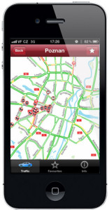 iOS application SeeTraffic received a wide-range map update thanks to full implementation of new TMC location table which CE-Traffic have created.
New maps have background advantages compared to old ones in these areas:
– more roads and streets covered,
– newly built roads added,
– better traffic view thanks to more detailed road network.
With these advantages we re-created the ‘old’ maps and added new ones:
– Gdansk,
– Krakow city center,
– Lodz city center,
– Poznan,
– Poznan city center,
– Slask,
– Trojmiasto,
– Wroclaw,
– Wroclaw city center,
– whole Czech Republic.
Premium RDS-TMC
PREMIUM RDS-TMC IN POLAND AND SLOVAKIA IS A SERVICE THAT COMBINES THE BEST FEATURES OF TRAFFIC MESSAGE CHANNEL TECHNOLOGY AND OUR UNIQUE REAL-TIME TRAFFIC DATA

CE-Traffic Premium RDS-TMC is the end-to-end solution designed for personal and in-car navigation systems. The service delivers real-time traffic information to drivers based on Traffic Message Channel (TMC) standard. Coded traffic data is broadcasted through FM RDS radio channel and decoded by TMC-equipped navigation system. Typical navigation device is able to display traffic messages, alert driver about traffic events and calculate an alternative route.

- Competitive advantage of CE-Traffic Premium RDS-TMC service is based on smart use of TMC standard components to deliver trust-worthy solution for drivers. The service is composed of high quality traffic data, up-to date location table and high capacity RDS channel, all combined to bring TMC technology to the next level.
Traffic data
- CE-Traffic is a provider of high quality traffic data in Central and Eastern Europe. We provide traffic flow information using Floating Car Data (FCD) technology based on 25 million kilometers of GPS tracks generated daily by tens of thousands vehicles. Information about traffic flow is than fused with information about accidents, road works, closed lanes and others. Smart aggregation and regional filtering allows for broadcasting only relevant traffic information.
TMC Location Table
- The system is based on TMC Location Tables (LT) in Poland (created by CE-Traffic) and public Location Table in Slokavia. Our unique Polish LT considers not only major interconnecting roads and urban streets but also lower category roads commonly used by drivers e.g. shortcuts or alternative routes. Taking into consideration rapid development of Polish road network our Location Table includes all major future changes in the backbone network until the end of 2016. CE-Traffic TMC Location Table has been certified by TISA (2013-114-PL).
RDS Radio Channel
- Radio channel is often considered to be a drawback of RDS-TMC technology compared to GSM-based solutions. Partnering with EuroZet in Poland and FunRadio in Slokavia, CE-Traffic created TMC service which allows broadcasting high number of traffic messages and high update rate. In order to achieve it Poland is divided into 9 zones so that out of more than 1000 messages sent in a real-time, drivers receive only these which are geographically relevant. Slovakia is covered with a single zone broadcasting over 100 message during “traffic intensive” days. Thanks to update rate which is typically not longer than a few minutes, the messages are delivered fast and always contain the most up-to-date traffic information.
TMC Location Table
WE CREATED AND MAINTAIN TMC LOCATION TABLE WHICH IS THE BEST AVAILABLE ROAD NETWORK MODEL FOR POLAND.

- TMC Location Table (LT) is a standard for coding locations of road events specified and standardized by TISA. Essentially it is a simplified model that provides location reference to road network built from points and connecting them lines. Each point and line has its own location code, which makes it possible to efficiently decode and visualize content on a map.
- CE-Traffic location table takes into consideration local behavior of Polish drivers which means that it consist not only of the most important interconnecting roads but also lower category roads which are commonly used by drivers e.g. touristic and alternative routes, which typically would not be included within the table. Moreover the last version of the table features all the major future road network investments until 2017.
Our TMC Location Table includes:
- all highways and express-roads
- all interconnecting roads
- major lower category roads
- streets in 30 Polish cities
- major touristic and alternative routes
- Our TMC Location Table has been implemented by major global and local geographic data providers including TomTom, Here and E-mapa. High Quality of our LT of is proved by TISA certification (2013-114-PL).
- Current version of the TMC Location Table: LT 306 ver. 3.0.
Jobs
- Our company offers highly innovative products and services in the area of mobility services both for commercial sector (navigations, mobile phones, internet) as well as for governments.
- We operate on innovative and dynamic markets with a potential to grow quickly. We are looking for creative personalities who understand opportunities in our business and are interested to develop skills with us.
- In case you are interested to become a member of our team, please contact us on info@ce-traffic.com. A motivation letter as well as topics to work on together are appreciated.
Public sector
-
Data generated by Floating Car Data system can offer a unique content for governmental agencies for traffic management and traffic monitoring tasks. Our real-time Live Traffic XML service and historical databases contain data about travel times, real-time speeds and other derivative information about traffic flow such as congestion status.
Live Traffic XML and Historical Data can serve for various purposes:
- monitoring traffic flow for lane control
- generation of travel times for variable message signs
- showing traffic on speed maps and congestion maps
- bottleneck analysis
- traffic allerts
- traffic modelling
Floating car data technology generates robust data about traffic situation on a continuous basis. The historical database is a very valuable content for:
- transportation planning, both on strategic as well as operative level,
- evaluations of influence of temporary as well as long term changes of traffic arrangements on traffic flow,
- source for advanced modeling of transport, urban planning, noise analysis and many other application areas.
Consulting Services
SAVE RESOURCES AND INCREASE EFFICIENCY. BASED ON OUR BROAD EXPERIENCE AND UNIQUE DATABASES WE PROVIDE TRAFFIC AND MOBILITY CONSULTING SERVICES, REPORTS AND EVALUATIONS.

CE-Traffic employs highly qualified professionals with industrial and academic backgrounds in the field of geographic information systems, mobility and transportation, who created one of the most innovative traffic and mobility data providing company in Central and Eastern Europe. Our business partners are government institutions, regional authorities, and private firms.
CE-Traffic owns one of the biggest, ever expanding historical traffic database which stores data from analysis of over 10 billion kilometres of anonymous GPS routes annually in Czech Republic, Poland and Slovakia. Our database allows for unique region-wide transportation analysis across the complete road network of CEE.
We are experts in DATEX II – European standard for data exchange in ITS. Our experts regularly organize on-deman workshops and seminars related to the topic.
We offer reports, evaluations, macro and micro scale analysis, before-after comparison analysis and custom analysis linked with transportation, traffic and mobility. Our team is prepared to work in close collaboration with all stakeholders in order to create smarter cities. We are proud to offer quality and professionalism.
Origin-destination analysis
UNIQUE STATISTICAL DATA ABOUT MOBILITY OF SOCIETY COMBINED WITH HIGH QUALITY TRAVEL TIME INFORMATION.
We provide unique analysis of origin-destination matrix for selected regions, cities, municipalities or custom area combined with precise travel time information from our traffic services. This empirical data gives unprecedented opportunity to transportation and urban planners, traffic engineers as well as government organizations.
Internet and media
-
Live Traffic XML are an ideal premium content to enrich standard maps available on mapping portals or other specialized web services. Live Traffic XML format can be implemented by the customers themselves into their existing mapping solutions. All the technical possibilities of visualizing the data, data interpretation and other functionalities based on traffic data is fully in hands of our customers opting for this solution.
-
Live Web Maps is a set of pre-defined maps optimized for web displaying current traffic by colored maps (based either on traffic loads or real speeds). Customer doesn’t have to program anything, just implement our maps into a web and has a professional presentation of traffic information. Live Web Maps can be adjusted according to customers specific requirements.
Enterprise
Currently used track & trace services are based on static maps. Routing as well as other functionalities are based on static model of the road network only. By embedding Live Traffic XML layer into your solutions, track & trace services providers can offer much more to their customers including completely new functionalities as well as new savings. By adding Live Traffic XML to your solutions, you could offer the following services to your customers:
- Visualization of real-time traffic situation in the control room
- Better route optimization reflecting real-time as well as predicted traffic situation
- Better arrival time predictions
More efficient journey planning and fleet management based on real-time and predictive traffic data.
Private: SeeTraffic for iPhone
SEETRAFFIC APPLICATION FOR IPHONE

- Are you interested in traffic in your city? SeeTraffic is the easiest and quickest way how to find out where are jams worth to avoid. Currently, SeeTraffic offers 13 most interesting traffic maps from Austria, Czech republic, Poland and Slovakia. Maps are updated every single minute and feeded with high quality data based on floating car data technology.
- Features and functions:
- Clean user interface
- Data refresh every single minute
- Real time traffic flow data shown by an intuitive colored scale
- Roadworks, closed roads and other incidents on roads included
- Traffic maps from four countries
- Coming update: more cities and roads
Live Web Maps
PROFESSIONAL VISUALIZATION OF TRAFFIC INFORMATION
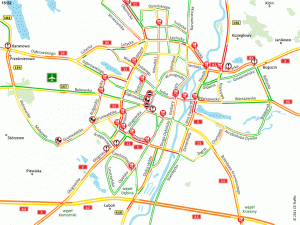
CE-Traffic Live Web Maps are generalized real-time and historical road traffic visualizations design for professional purposes. We offer schematic maps of cities and regions in Central and Easter Europe as well as visualizations customized for particular projects.
Live Web Maps of cities and regions are generalized, schematic maps of cities and regions design for media, organizations and agencies where real-time, helicopter view of traffic in needed to detect problems and enhance and enable rapid decision making.


